|
The Sixteenth-Century World Digital History ID 3986
Credit: Library of Congress
Media type: map
Museum Number:
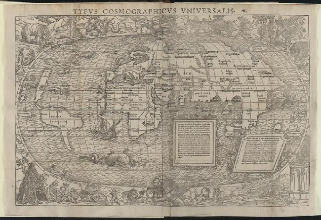
Annotation: This early anthology of the lands and peoples of the Americas, includes letters and descriptions of the voyages of Marco Polo, Columbus, and Vespucci. A truly remarkable feature of the work is a world map, possibly drawn by Sebastian Münster, and, in part, by Hans Holbein the Younger. The Americas are clearly depicted, based partly on the world as configured by the Johann Schöner globes or on Peter Apian's map of 1520, and showing the influence of the ideas of Copernicus. The scenes and vignettes that surround the oval projection are particularly interesting images, reflecting European views of this new world as a place where cannibals, monsters, and other dangers lurked.
Year: 1532
Copyright 2021 Digital History
|